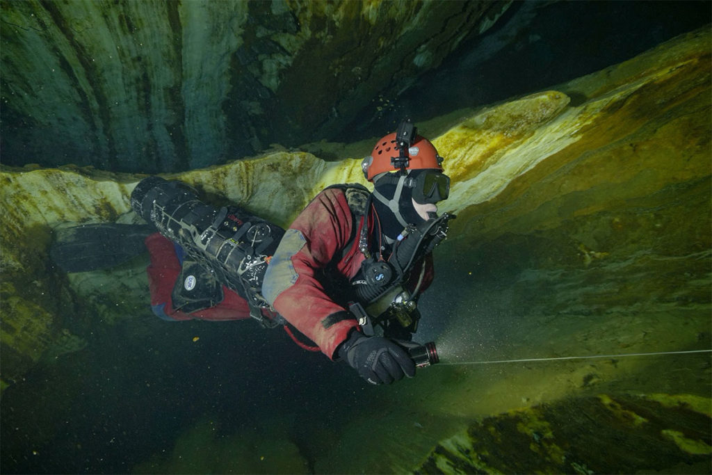
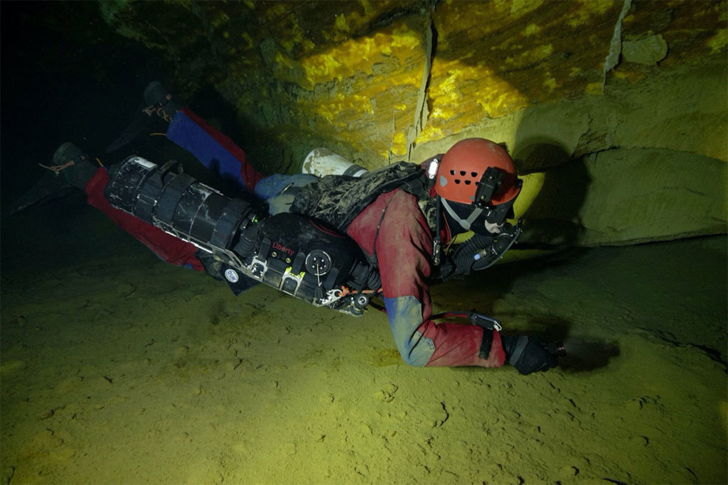
Czech divers and geodesists are the first in Europe to 3D scan underwater parts of the Chynov cave. They first filmed the Chynov Cave by video and then created a 3D model using videogrammetry testing the limits of the method. Their motivation, moreover, was to also update the map originally created in the 1980s, to be more accurate, down to the centimeter.
A flooded cave system is located in the Tabor region of the Czech Republic, approximately 100km south of Prague. Divers Petr Chmel and Miloslav “Mejla” Dvoracek have been cooperating with geophysicist Jiri Sindelar on the Chynov Cave project since 2017. Initially, they needed to set the scope of their overall work and optimize procedures for imaging the cave. Petr and Mejla finished filming the partially mapped chimney and completed data collection for the 3D model in May 2019.
Diver Petr Chmel explained that the camera had to be very still while shooting. This was mainly to facilitate the subsequent image processing as the morphology of the cave had to be well captured. Divers used cameras with 4k resolution, because shooting is particularly demanding due to the lack of lighting. The whole team faced various challenges when mapping – the biggest, however, was the water’s high turbidity in the cave.
Jiri Sindelar’s team from Geo-cz, who introduced the issue of reference points and mapping of spaces that do not fit into one “camera”, used non-destructive exploration technology to help explore historical objects and archaeological sites. The team consisted of experienced cave divers, including Petr Chmel, Miroslav Dvoracek, Josef Kanta and Rafael Krzewinski, who have all accomplished several shootings and underwater photography in this cave. Therefore, in preparation, they focused their discussions on scanning specific tunnels, branches, and other karst formations. Subsequently, they evaluated the images and as a result, were the first in Europe to succeed in making a detailed 3D model of the flooded cave system.
“The Chynov Cave, an important geological and mineralogical locality, is complex in shape, very muddy and its deepest parts are only accessible through a restricted space which is connected to a very low corridor. The recording could only be accomplished in route to the cave as there was zero visibility on the return,” says diver Petr Chmel. The Cave was formed in coarse-grained crystalline limestones and partly in non-karst rocks and amphibolites, mainly by corrosion from underground water. Despite the lack of classical stalactite decoration, the cave is very unique due to its modeling of spaces and colorful walls and ceilings. Further, it’s Europe’s largest natural wintering ground for bats and in 1992 was categorized as a national natural monument.
“We modified the technologies used for the archeological documentation of the sites for the divers. In a twenty-minute dive, we were able to scan 200 meters of the cave using this method,” adds Jiri Sindelar. The three-dimensional model of the cave will be used for further explorations, perhaps to seek out new water sources. “The water from the Chynov Cave is used for the Chynov village’s water supply,” notes Frantisek Krejca from the Chynov Cave Administration.
The mapping of Chynov Cave was accomplished over nine total dives. Six of the dives were mainly for preparation, whereby the team had to remap the classical method and set the reference points for dimension verification. And the other three dives were critical due to the high opacity of the cave. Overall, the mapping of the Chynov Cave lasted nearly a year.
Petr Chmel also helped with the map data verification for the artillery fortress, Skutina, in Orlicke Hory and with creating the video which documented the P3 descent shaft. The fortress buildings were flooded with groundwater soon after they were abandoned in 1938 and there were no accurate plans of the mined galleries left behind. However, due to the expansion of the museum and the accessibility of the galleries, the existing plans were brought to life.
About Petr Chmel
Petr Chmel first began diving in 1994, and in 2005, started focusing more on underwater cave diving. As a part of the base organization, Speleoaquanaut within the Czech Speleological Society, he has actively participated in the 3D mapping of the Chynov Cave, Blue Marino cave discoveries in Sardinia, and cenote explorations in the Tux Kupaxka System on the Yucatan Peninsula.

Currently, he enjoys exploring and mapping caves, as well as the “unlimited” diving options using the main back mounted Liberty and sidemount Liberty as a Bailout (plus 12 l tank). His favorite locations are in caves where clean water flows, but most of his dives are in dams with temperatures of around 5° C and visibility of approximately 2 meters. To access some of the caves, because there are often vertical slopes, knowledge of SRT (single rope technique) is a necessity. Petr is currently working with Liberty backmount + sidemount, because of their reliability and durability. However, when diving into small places and narrow tunnels, he uses the Liberty sidemount.
In addition to exploration diving, Petr works as an energy specialist and, apart from time with his family, also enjoys hiking, skialpinism and speleoalpinism in general.


