The state-of-the-art robotic float is essential for revealing how much carbon the ocean stores, and how that might change in the future.
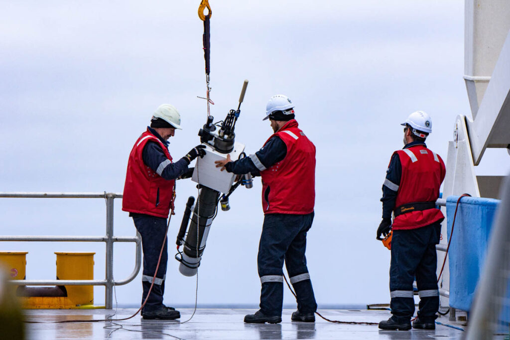
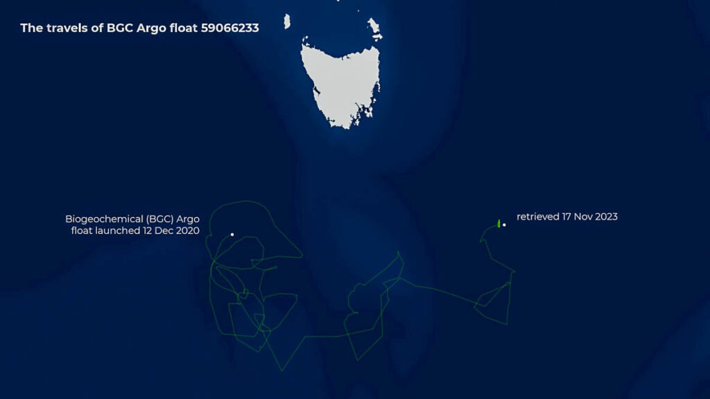
In a first for CSIRO’s research vessel (RV) Investigator, a state-of-the-art robotic float has been recovered from the Southern Ocean after its three-year mission sampling deep waters about 500 kilometres south of Tasmania.
Argo floats drift at a ‘parking depth’ of 1000 metres, then sink to 2000 metres and rise to the surface every 10 days, taking measurements along the way. At the surface they transmit the data via satellite, then descend again.
BGC (for biogeochemical) Argo float no.5906623 performed this cycle 290 times since it was released from RV Investigator on 12 December 2020.
In nearly three years of continuous diving, the float provided valuable data on temperature, salinity, algal concentration, suspended matter, oxygen, nutrients, light available for primary production, and pH of sea water.
This is the first recovery of a BGC-Argo float of this kind in the Southern Ocean.
Dr Christina Schallenberg, a CSIRO scientist and Biogeochemical Argo leader with the Integrated Marine Observing System (IMOS), said the technology is essential for revealing how much carbon the ocean stores and how that might change in the future.
“In addition to the full set of biogeochemical sensors, this float has an Underwater Vision Profiler, which is basically a camera that takes pictures of particles in the water column,” Dr Schallenberg said.
“While the float is only able to transmit counts of particles, it should have stored the actual images. Now we’ve recovered the float, we’ll get access to the images.
“Not only will this tell us the size of particles, but what they are – faecal pellets, fresh plankton, other detritus – which is crucial for knowing how the sinking of these particles moves carbon from the surface to the deep ocean.”

Although the float is difficult to spot at sea, with only a small antenna above the water, the ship was able to home in on the Argo’s location when it switched to transmitting GPS coordinates every 10 minutes.
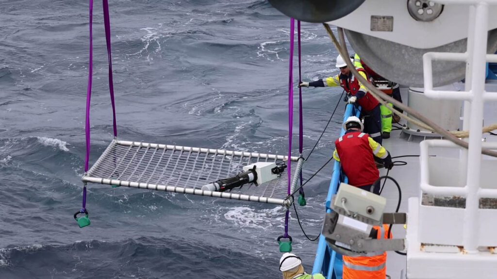
CSIRO’s Jason Fazey, from the Marine National Facility, said the Argo float recovery net had been developed to enhance RV Investigator’s ability to support long-term ocean studies.
“We looked at systems other research organisations use, and worked with our Field Operations team to design a similar system that was customised for RV Investigator,” Mr Fazey said.
“The recovery net is effectively a prototype we were testing operationally for the first time, having previously only conducted trials in the relatively sheltered Storm Bay, off Hobart – we didn’t know how it would behave in the swell of the Southern Ocean.
“The recovery operation was a tricky dance between wind and currents to manoeuvre the ship into position. Once the float was moving alongside the ship, it took careful coordination between the bridge officers and the skilled deck crew to catch the two-metre long, 100-kilogram float with a small net.
“With a successful debut after a great team effort, we now have some ideas to refine the design and operation of the recovery device.”
A range of science agencies in Hobart are enmeshed in the life of this BGC-Argo float – it is owned by the Institute for Marine and Antarctic Science (IMAS); it was deployed by an Australian Antarctic Program Partnership voyage in 2020; float preparation and data delivery, funded by IMOS, was managed by CSIRO.
Dr Benoit Legresy, CSIRO oceanographer and chief scientist of the research voyage that picked up the float, said deploying autonomous devices like robotic floats and gliders also means developing a capability to recover them.
“This float is the biggest we’ve ever deployed, and the recovery net worked well after several attempts,” Dr Legresy said.
“When we picked it up the float still had enough battery life for some more deep dives, but if we hadn’t got it before winter, it wouldn’t have lasted another year. The rich data it contains is priceless.
“I’m excited by this recovery because the wider use of autonomous instruments like these floats offers great potential for more breakthrough science from the Southern Ocean.”
This research is supported by a grant of sea time on RV Investigator from the CSIRO Marine National Facility which is supported by the Australian Government’s National Collaborative Research Infrastructure Strategy (NCRIS).
Australia’s Integrated Marine Observing System (IMOS) is enabled by the National Collaborative Research Infrastructure Strategy (NCRIS). It is operated by a consortium of institutions as an unincorporated joint venture, with the University of Tasmania as Lead Agent.


