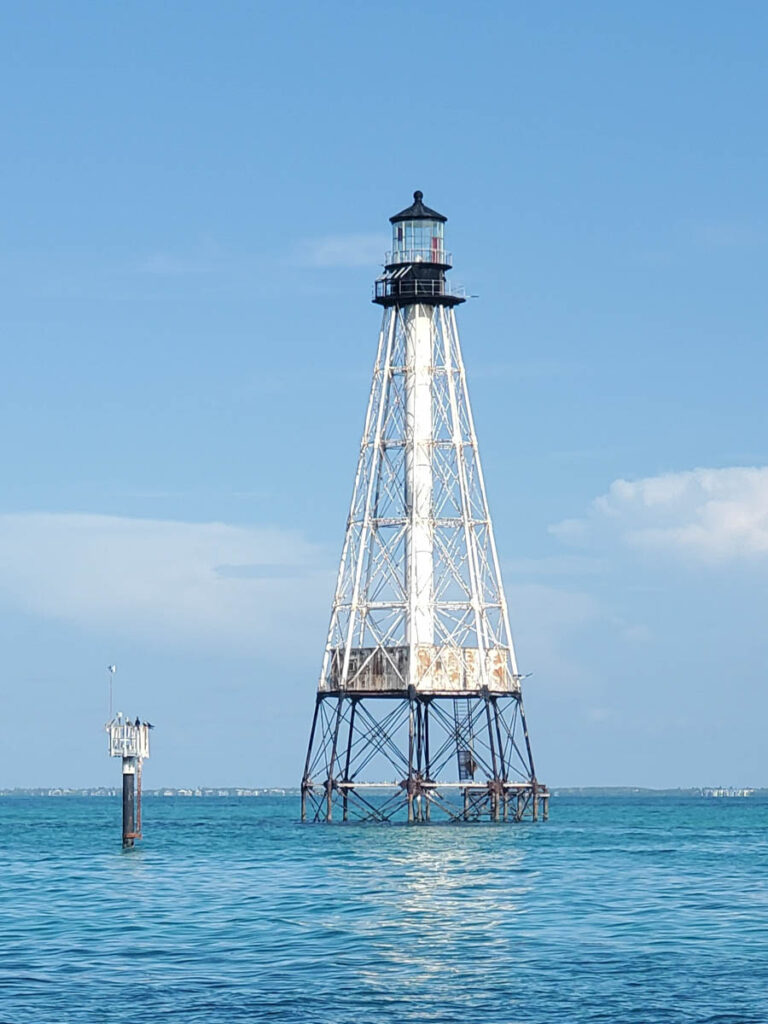
The Swim for Alligator Lighthouse is an annual 8 mile open water swim that takes place in Islamorada, Florida and is a challenge.
Tom Ward (redbull.com) says this swim is one of the eight toughest swims in the world. This is swimming in tropical open water. If you’ve never done anything like this before, you’ll be met with stunning (albeit stinging) and beautiful marine life. Every year, people return to conquer Alligator Light. This year the date for the swim is September 7, 2024. The swim for the Alligator Lighthouse will have a maximum of 490 participants. Solo, 2-person, 3-person, and 4-person relays.
Alligator Reef Lighthouse
Alligator Reef Light is located 4 nautical miles (7.4 kilometres; 4.6 miles) east of Indian Key, near the Matecumbe Keys in Florida, and north of Alligator Reef. The station was established in 1873. It was automated in 1963 and was last operational in July 2014. It was replaced by a 16-foot steel structure with a less powerful light located adjacent to it. The structure consists of an iron pile skeleton and a platform. The light is 136 feet (41 meters) above the water. It is a white octagonal pyramid skeleton framework on a black pile foundation that houses a square dwelling and a stair cylinder. The new light has a range of approximately 7 nautical miles (13 kilometres or 8.1 miles).

The name honours the US Navy schooner Alligator, a member of the newly formed US Navy Anti-Piracy Squadron in Key West, Florida USA which ran aground here in 1822. The Alligator was blown up after removing as much as possible to keep pirates from using it. Numerous vessels have also sunk on the reef’s jagged coral.
In 2021, Friends of the Pool, an Islamorada-based community organization, was granted title to the lighthouse. The organization changed its name to Save Alligator Lighthouse and raised $6 million to restore the lighthouse. Solar-powered lights were installed and turned on in October 2023.
Alligator Reef Light is on the USCG light list and National Register of Historic Places listed location. (Aids to navigation used for general navigation that are maintained or controlled by the United States Coast Guard and are located in the waters surrounding the United States and its territories.)


