


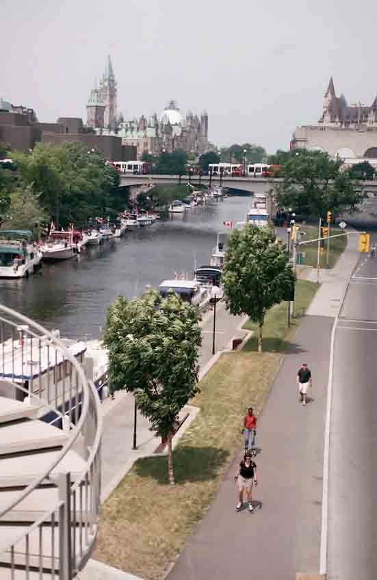
The Rideau Canal is a waterway that spans the Rideau and Cataraqui rivers and links Kingston, Ontario, on Lake Ontario, with the city of Ottawa, Ontario, Canada, on the Ottawa River. The Rideau Canal is still in use today, having been finished in 1832.
Before the Rideau Canal was constructed, the land’s topography was much different from what it is now. The proposed lockstation at Brewer’s Upper Mills was 10.8 miles (17 km) from Jones Falls. There was just one little lake (Cranberry Lake) and a lot of marshes between Jones Falls and Brewer’s Upper Mills. Water drained in two directions: east from the southern Rideau lakes (Newboro, Clear, Indian, Opinicon, and Sand) to the Gananoque River via White Fish Creek (now Morton Creek) and south from Loughborough and Dog lakes to the Cataraqui River via Cranberry Lake.
The main issue was Cranberry Bog, which is situated approximately north of the site. Work at Upper Brewers was stopped in the summer of 1828 because of the severe malaria that was prevalent in this swampy location. Using two dams—one here at Upper Brewers and another close to modern-day Morton—to flood the region was the answer. The present-day Cranberry, Little Cranberry, and Whitefish lakes were created by the water those dams flooded.
There were concerns about American attacks against the British Empire’s territories, which are now part of Canada, at the time it was conceived, which was sometime after the War of 1812. The British Empire constructed a number of forts and canals to protect its land and deter future invasions. Canals were constructed simultaneously to traverse the Long Sault rapids on the Ottawa River as part of the Montreal-Ottawa-Kingston navigation route.

Securing the communications and supply line between Kingston and Montreal was the canal’s primary military function. The route traveled west from Montreal along the Ottawa River to Bytown, which is now Ottawa, and then southwest via canal to Kingston (and the other way around, from Kingston to Montreal). The goal was to avoid the St. Lawrence River’s narrow passage, which would have made British supply vessels susceptible to attack and marked the boundary between Upper Canada (modern-day Ontario) and New York State.
After the canal was finished, there were no more disagreements between the US and Canada. As a result, the canal was never put to its intended use. But compared to the St. Lawrence River, which had a number of rapids between Montreal and Kingston, the canal was simpler to cross. It thus developed into a bustling trade route connecting Montreal and the Great Lakes. Tens of thousands of people arrived from the British Isles at this time, and it served as the primary route for immigrants moving west to Upper Canada. Additionally, it served as a vital route for the transportation of heavy commodities from the Canadian hinterland to Montreal via the east, including grain, minerals, and lumber.
The Rideau Canal is now only used by leisure boats. Boaters may easily navigate the canal between Ottawa and Kingston, and tours of the city are provided. Even now, the locks are still operated manually. Along the canal, there are 22 lockstations and 47 locks.
Parts of the Rideau and Cataraqui rivers, as well as a number of lakes, including Great Rideau Lake, are part of the 202-kilometer Rideau Canal. The canal’s 19 kilometers are man-made.
It is the oldest canal system in North America still in use. On June 28, 2007, UNESCO declared it a World Heritage Site.
The Scuba News Canada dedicates this article to Christopher Haslip — a dear friend, a passionate voice for the Kingston dive community, and a trusted guide whose spirit and knowledge will be deeply missed. Chris passed away In April doing what he liked best — scuba diving!
Video: Explorer Diving, Kingston, Ontario
Comments